


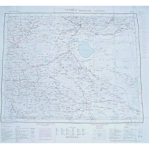
Silk Escape Map, Bushire/Tehran
- 5 Star Customer Service
- Family Owned and Operated
Description
Bushire on one side, displays Southwest Iran, and the Northern Persian Gulf. Tehran on the other, displays Central Iran. Originally issued to UK pilots during the Cold War. If they were shot down, these 100% silk topographical and political maps of Eastern European regions show the most convenient escape routes, including railroads, rivers, mines, swamps and more. Screened onto double-sided silk so that they could be used when wet and would not become illegible. Published by War Office 1942. This is the Fourth Edition which was revised and reproduced by Ordnance Survey in 1951. Measurement: Height is 24½ in. Width is 26½ in. Wonderful collectors items. New.
Prop 65 Ca Residents Only
WARNING: Cancer and Reproductive Harm -
www.P65Warnings.ca.gov.
Ask The Community A Question
Please use this form to ask questions PUBLICLY about this specific product to previous customers of this product. Your question and any details in it will be posted to our website and sent to previous customers, and is not guaranteed an answer.
Please direct any questions that you would like to ask directly to Coleman's staff, or need answers to in a timely fashion, to our Contact Us page to e-mail Coleman's staff directly.
Related Products
